| |
|
Nationwide Differential GPS (NDGPS) System
|
The U.S. Coast Guard's Navigation Center (NAVCEN) operates maritime radiobeacons in the 285-325 kHz band that include a digital data broadcast of differential GPS corrections. These beacon signals are part of the Nationwide Differential GPS (NDGPS) Service. The system consists of one control site and 86 remote broadcast sites, which formally occupy center frequencies ranging from 286 to 325 kHz. The links below include a list of all broadcast sites.
According to the Coast Guard: "NAVCEN operates the Coast Guard Maritime Differential GPS (DGPS) Service and the developing Nationwide DGPS Service, consisting of one control center and 86 remote broadcast sites. The Service broadcasts correction signals on marine radiobeacon frequencies to improve the accuracy and integrity to GPS-derived positions. The Coast Guard DGPS Service provides 10-meter accuracy in all established coverage areas."
|
Frequency Bands |
| Band | Use | Service11 | Table |
| 285 - 325 kHz | NDGPS Broadcasts on Marine Radiobeacons | Maritime Radionavigation | F |
Associated Files:

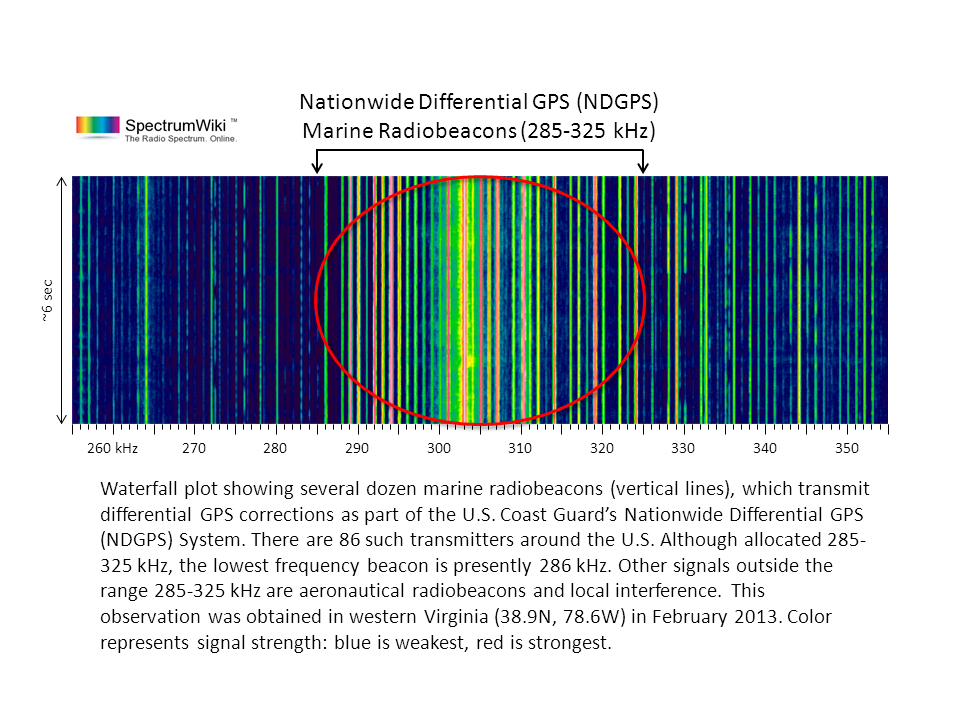
Waterfall plot showing several dozen marine radiobeacons (vertical lines), which transmit differential GPS corrections as part of the U.S. Coast Guard’s Nationwide Differential GPS (NDGPS) System. There are 86 such transmitters around the U.S. Although allocated 285-325 kHz, the lowest frequency beacon is presently 286 kHz. Other signals outside the range 285-325 kHz are aeronautical radiobeacons and local interference. This observation was obtained in western Virginia (38.9N, 78.6W) in February 2013. Color represents signal strength: blue is weakest, red is strongest.
|
|
|
|
|