| |
|
Emergency Position Indicating Radiobeacon (EPIRB); Emergency Locator Transmitter (ELT); Personal Locating Beacon (PLB)
|
EPIRBs, ELTs, and PLBs are various forms of radiobeacons that are used to locate people in distress. Generally, the term EPIRB is used for maritime distress beacons, ELT refers to an aviation beacon; and PLB refers to beacons worn on individuals (for example, hikers).
The beacons normally remain silent, and are activated either manually or automatically (for example, when they detect water) in case of an emergency. Their beacon signal can then be picked up by a receiver, and used to locate the device.
The beacons operate on one or more of three worldwide frequencies: 121.5, 243, and 406 MHz. However, since Feb 1st, 2009, 121.5 and 243 MHz signals are no longer received by satellites, and can therefore be much harder (and take much longer) to locate. Newer 406 MHz beacons can be located by a variety of satellites, including the COSPAS-SARSAT system established by the U.S., Russia, Canada, and France. Some 406 MHz beacons have built-in GPS receivers, and can encode their latitude and longitude in their beacon transmission. With these types, even geostationary satellites, such as the GOES weather satellites, can relay an accurate location of the beacon to authorities.
The satellite receivers in the 406 MHz band have a bandwidth of 24 kHz. The 406 MHz beacons transmit their signals at a bit rate of 400 bps.
EPIRBs are a component of the International Maritime Organization's (IMO's) Global Maritime Distress and Safety System (GMDSS).
Galileo, the European radionavigation-satellite system, will incorporate receivers for the 406 MHz beacons, and may even be able to talk back. According to the European Space Agency, "Galileo is to play an important part of the Medium Earth Orbit Search and Rescue system (MEOSAR). Galileo satellites will be able to pick up signals from emergency beacons carried on ships, planes or persons and ultimately send these back to national rescue centres. From this, a rescue centre can know the precise location of an accident. At least one Galileo satellite will be in view of any point on Earth so near real-time distress alert is possible. In some cases, feedback could be sent back to a beacon, something which is only made possible by Galileo."
EPIRBs transmit a 0.5s burst every 50 seconds, according to the ITU. More information on the Cospas-Sarsat system is available in ITU-R Report SM.2258 (link below).
|
Frequencies |
| Frequency | Bandwidth | Use | Service | Table |
| 121.5 MHz | 3 kHz | EPIRB/ELT/PLB (analog, older style, no longer tracked by satellites) | - | - |
| 243 MHz | 3 kHz | EPIRB/ELT/PLB (analog, older style, no longer tracked by satellites) | - | - |
Frequency Bands |
| Band | Use | Service | Table |
| 406 - 406.1 MHz | EPIRB/ELT/PLB (digital) | Mobile-satellite | - |
External Links:
Display this entry in a page by itself
Edit
|
|
|
|
|
|
|
|
Radiosondes
|
According to the U.S. National Weather Service:
In order to understand the dynamic processes that result in the weather we experience, we need to know what is happening through the entire atmosphere. These observations are primarily taken with the aid of radiosondes.
The radiosonde is a small instrument package that is suspended below balloon filled with either hydrogen or helium. As the radiosonde is carried aloft, it measures pressure, temperature, and relative humidity.
These sensors are linked to a battery-powered radio transmitter that sends the information to a ground receiver. By tracking the position of the radiosonde in flight via GPS (Global Positioning System), measurements of wind speed and direction aloft is also obtained.
Worldwide, most radiosonde observations are taken daily at 00Z and 12Z (6 a.m. and 6 p.m. EST). With worldwide coordination of these upper air observations, we can obtain a picture of the various pressure and wind patterns across the globe.
Radiosonde observations technically provide only pressure, temperature, and relative humidity data; the tracked position of a radiosonde is actually called a rawinsonde observation and is used to obtain wind speed and direction. However, meteorologists and other data users frequently refer to them as part of the radiosonde observation.
The radiosonde flight can last in excess of two hours, and during this time the radiosonde can ascend to over 115,000 feet (35,000 m) and drift more than 125 miles (200 km) from the release point. During the flight, the radiosonde is exposed to temperatures as cold as -130°F (-92°C) and air pressures of only a few hundredths of what is found on the Earth's surface.
When the balloon has expanded beyond its elastic limit (20-25 feet in diameter) and bursts, the radiosonde returns to Earth via a small parachute. This slows its descent, minimizing the danger to life and property.
If found, radiosondes are safe to handle, as long as the balloon is deflated. Cut the string to the balloon/parachute and place them in a trash receptacle. You may also dispose of the radiosonde itself or keep it.
Worldwide, there are about 1,300 upper-air stations. Observations are made by the NWS at 92 stations: 69 in the conterminous United States, 13 in Alaska, nine in the Pacific, and one in Puerto Rico.
NWS supports the operation of 10 other stations in the Caribbean. Through international agreements, data are exchanged between countries worldwide.
|
Frequency Bands |
| Band | Use | Service | Table |
| 400.15 - 406 MHz | Radiosondes | Meteorological Aids | F |
| 1675 - 1685 MHz | Radiosondes | Meteorological Aids | F |
External Links:
Associated Files:

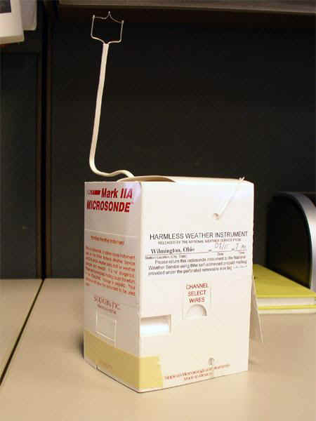
A Lockheed Martin Mark IIA Microsonde (radiosonde).

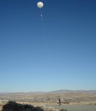
Preparing to launch a radiosonde (Reno, NV area).
Display this entry in a page by itself
Edit
|
|
|
|
|
|
IEEE 802.15.4 HRP UWB
|
High pulse repetition frequency ultra-wideband (HPR UWB) is one of the physical layers defined for low data rate personal area network (LR-WPAN) communications in the IEEE 802.15.4 standard.
According to the FiRa Consortium:
"In challenging environments, such as parking structures, hospitals, airports and high density venues, ultra-wideband (UWB) technology outperforms other technologies in terms of accuracy, power consumption, robustness in wireless connectivity, and security, by a wide margin.
"UWB securely determines the relative position of peer devices with a very high degree of accuracy and can operate with line of sight at up to 200 meters. In contrast to narrow band wireless technologies, the use of wide bandwidth means UWB provides very stable connectivity, with little to no interference and offers highly precise positioning, even in congested multi-path signal environments.
"By calculating precise location, fine ranging based on UWB is a more secure approach to closing and opening locks, whether those locks are installed on a car door, a warehouse entryway, a conference room, or your front door."
|
Frequencies |
| Frequency | Bandwidth | Use | Service | Table |
| 499.2 MHz | 499.2 MHz | 802.15.4 HRP UWB Channel 0 | - | - |
| 3494.4 MHz | 499.2 MHz | 802.15.4 HRP UWB Channel 1 | - | - |
| 3993.6 MHz | 499.2 MHz | 802.15.4 HRP UWB Channel 2 | - | - |
| 3993.6 MHz | 1.3312 GHz | 802.15.4 HRP UWB Channel 4 | - | - |
| 4492.8 MHz | 499.2 MHz | 802.15.4 HRP UWB Channel 3 | - | - |
| 6489.6 MHz | 1.0816 GHz | 802.15.4 HRP UWB Channel 7 | - | - |
| 6489.6 MHz | 499.2 MHz | 802.15.4 HRP UWB Channel 5 | - | - |
| 6988.8 MHz | 499.2 MHz | 802.15.4 HRP UWB Channel 6 | - | - |
| 7488 MHz | 499.2 MHz | 802.15.4 HRP UWB Channel 8 | - | - |
| 7987.2 MHz | 1.3312 GHz | 802.15.4 HRP UWB Channel 11 | - | - |
| 7987.2 MHz | 499.2 MHz | 802.15.4 HRP UWB Channel 9 | - | - |
| 8486.4 MHz | 499.2 MHz | 802.15.4 HRP UWB Channel 10 | - | - |
| 8985.6 MHz | 499.2 MHz | 802.15.4 HRP UWB Channel 12 | - | - |
| 9484.8 MHz | 1.35497 GHz | 802.15.4 HRP UWB Channel 15 | - | - |
| 9484.8 MHz | 499.2 MHz | 802.15.4 HRP UWB Channel 13 | - | - |
| 9984 MHz | 499.2 MHz | 802.15.4 HRP UWB Channel 14 | - | - |
External Links:
Associated Files:

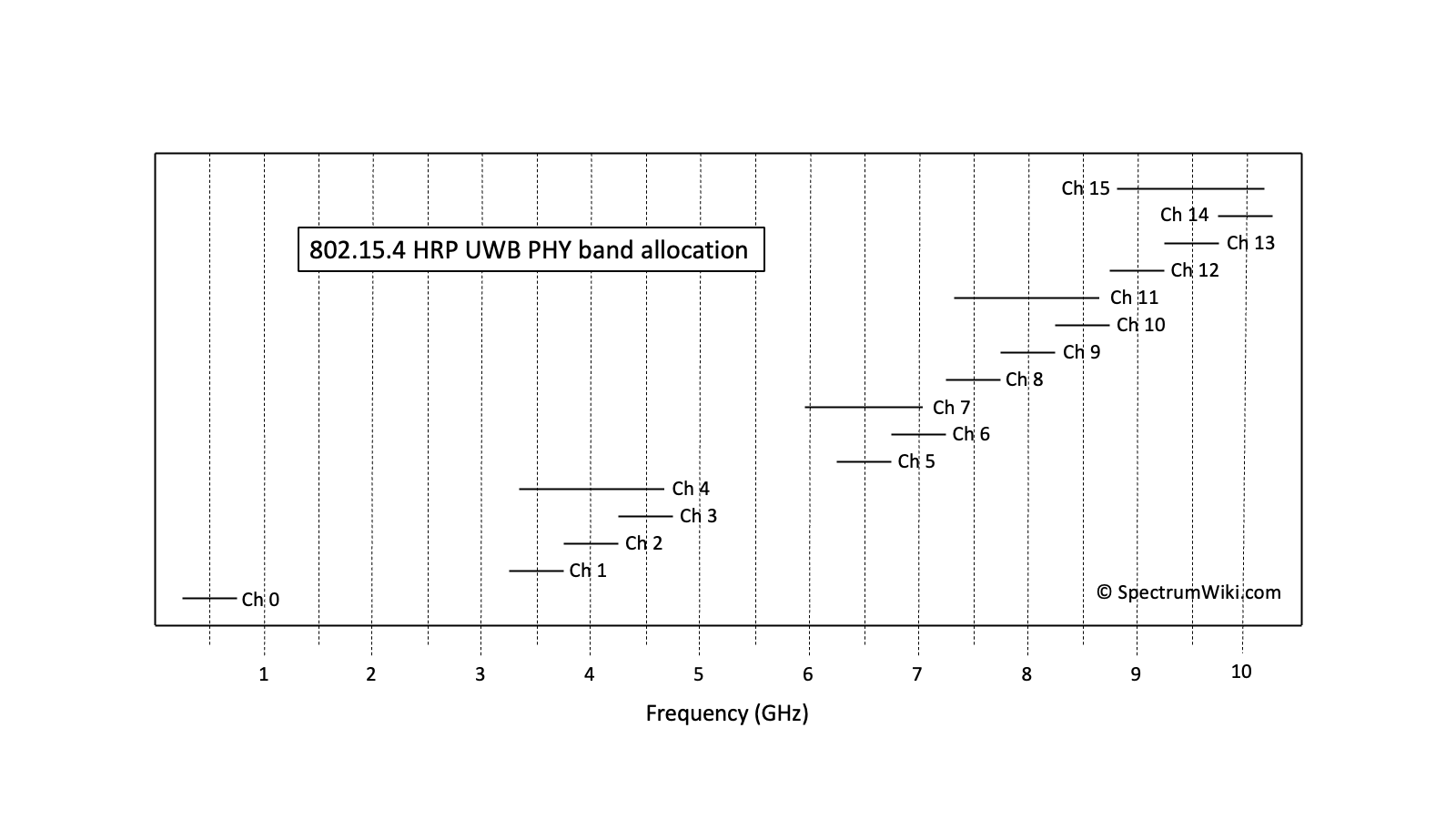
802.15.4 HRP UWB PHY band allocation
Display this entry in a page by itself
Edit
|
|
|
|
|